

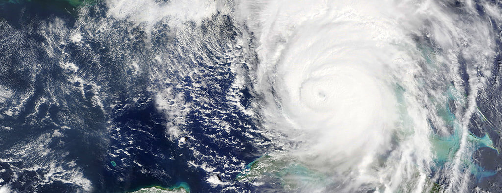
Tropical Storm Melissa has slowed to a crawl in the Caribbean, inching forward at just 2 mph, leaving forecasters with an “extremely uncertain” forecast of the storm’s next stops.
Over the last day, the forecast track shifted west, bringing Melissa south of Jamaica early next week as a Category 3 hurricane. All of Jamaica remains under a tropical storm warning, and the southern peninsula of Haiti is under a hurricane warning.
For now, most long-range storm models all show the storm moving north through the islands — either Haiti, Cuba or somewhere in between — and avoiding Florida and the Gulf. However, they are still split between a faster path north, running through Hispaniola over the weekend, or a more lingering track that could bring the eye of a powerful, major storm over Jamaica and Cuba next week.
The 11 a.m. forecast update nudged west, favouring the latter path. But the National Hurricane Centre warned that the uncertainty around Melissa’s future path could lead to “serious changes” in the forecast in the next few days.
“It goes without saying, this is a very challenging track forecast,” forecasters wrote in the 11 a.m. update.
For the next few days, the hurricane centre said Melissa will be steaming in hotter-than-usual waters in the Caribbean, fuelling the storm’s growth, but also battling a significant amount of storm-toppling wind shear. Those two competing factors are part of the reason the forecast is tougher than usual.
It’s too soon to say whether one will win out over the other and make Melissa either a stronger or weaker storm. It’s currently expected to become a hurricane as soon as Friday.
Another trend emerging in the models and the forecast data is that the longer Melissa dawdles in the Caribbean before moving north, the more time it has to strengthen into a powerful, potentially major hurricane. “The intensity forecast is also more uncertain than usual, in large part related to the track uncertainty,” forecasters said Wednesday at 11 a.m.
As of 2 p.m. Wednesday, the storm had maximum sustained winds of 50 mph. Regardless of how strong Melissa gets, the immediate threat in the Caribbean is rain.
Even a weak storm could dump a ton of rain on the mountainous island of Hispaniola, potentially setting off life-threatening mudslides and flash flooding. Eastern Jamaica, the southern Dominican Republic and southern Haiti are expected to see between 5 and 10 inches of rain through Friday.
Western Jamaica and the northern end of Hispaniola could see 2 to 4 inches of rain. Five of Haiti’s 10 regional departments have been placed under yellow alert.
Emanuel Pierre, head of Haiti’s Civil Protection Office, says while there isn’t an exact precision on where the storm will hit, they have mounted an aggressive communications campaign in regions close to Haiti’s southern peninsula, which is most under threat. “It’s a huge threat for the regions, for Haiti,” he said of Melissa.
Since Tuesday night, some areas have started to receive rainfall. In addition to mudslides and overflowing rivers, Haiti faces the threat of cholera. The waterborne disease is showing a resurgence with the United Nations saying this week that since Sept. 8th, health authorities have reported new cases in the commune of Pétion-Ville, following 11 weeks with no cases confirmed across the country. Petion-Ville is located in the capital.
In just a single week this month, the country recorded 139 suspected cases, including more than 20 laboratory-confirmed cases. Five deaths were also reported, the U.N. said.
Pétion-Ville, as well as parts of the capital of Port-au-Prince, including Cité-Soleil, remain on red alert, amid concerns over cholera spreading at sites hosting internally displaced people, which now number more than 1.4 million. Pierre said cholera remains a concern, despite the distance between both regions.
“We know we are vulnerable and can’t afford a big hit,” he said of the storm. “This system is charged with a lot of rain and rain is our biggest enemy.”